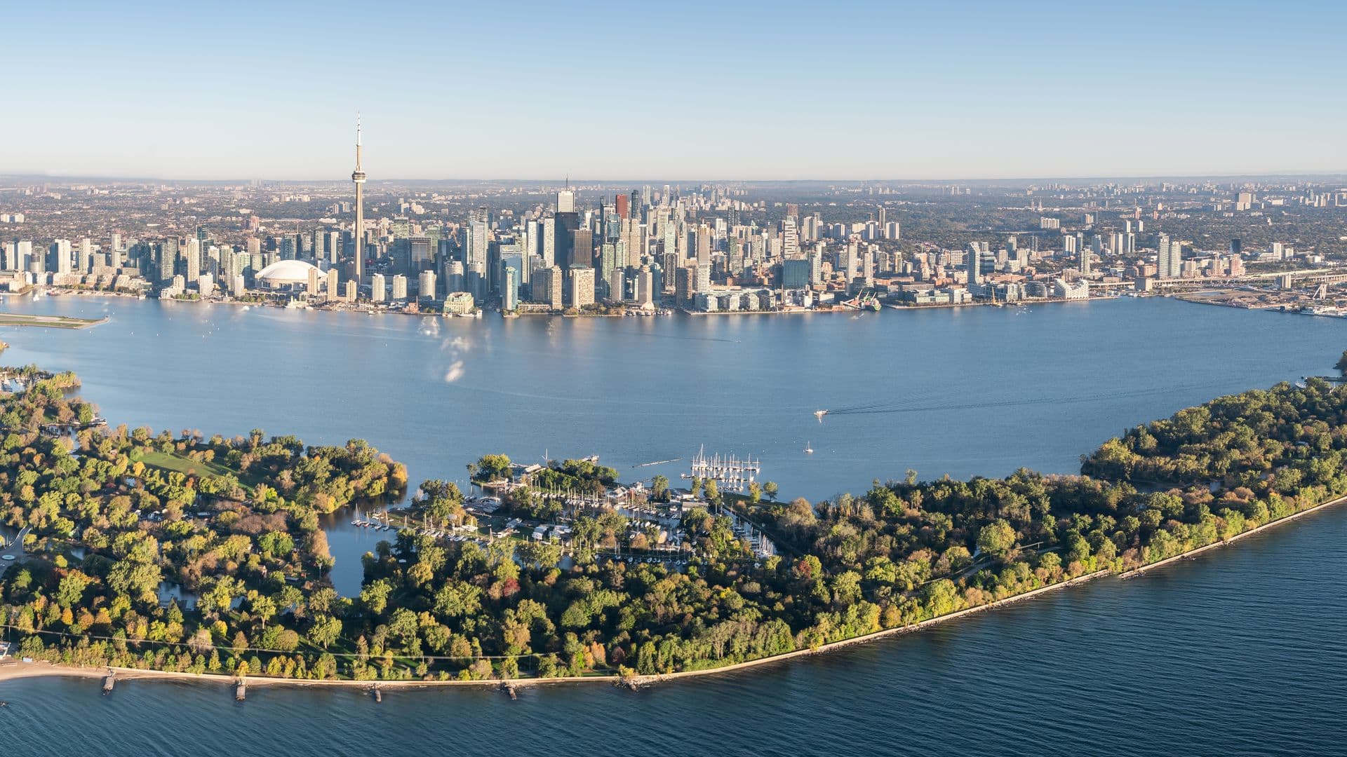
With a rich history, the Waterfront has undergone significant redevelopment in recent years, transforming it into a popular destination for locals and tourists alike.
We want to acknowledge that the land upon which we operate is the traditional territory of the Mississaugas of the Credit First Nation and that Toronto is covered by Treaty 13 with the Mississaugas of the Credit First Nation (MCFN).
The waterfront’s vibrant history may come with some surprises so we put together a list of the 5 things you likely didn’t know about Toronto’s waterfront.
Surprising Facts About Toronto's Waterfront:
1. Horse-Powered Ferries
Today, visitors can travel to the Toronto Islands in under 15 minutes in diesel-fueled ferries or water taxis. The journey to the Islands is its own experience, giving travellers a breathtaking view of the city.
But 190 years ago (or in the mid-1800s) – the travel to the Islands was very different. In fact – visitors could get to the Islands by walking on a narrow strip of land or through a ferry service.
One of the original Toronto ferries was known as the ‘Sir John of the Peninsula’ and another ferry was known as the ‘Peninsula Packet’ because, at the time, the Toronto Islands was a peninsula and not yet Islands.

Both vessels were horse-powered. Originally, two horses would powerwalk a treadmill that was connected to side paddles, propelling the boat into movement. Later, the vessels could accommodate up to five horses on a circular treadmill.
We can assume that the travel times were longer than 15 minutes.
Our current ferry boats have been in operation for 60 – 80 years, and the City of Toronto is closer than ever to replacing the fleet with fully electric ships that will reduce greenhouse gas emissions by 2, 800 tonnes annually.
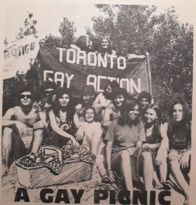
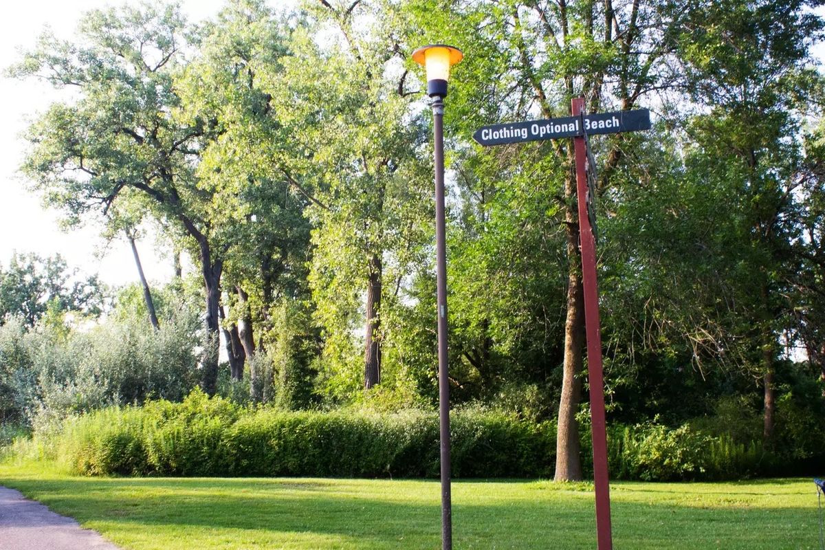
2. Toronto’s First Gay Pride Was on Toronto Island
The first organized pride celebration began as a picnic in 1971 on the Toronto Islands at Hanlan’s Point Beach. This official pride picnic gave birth to the iconic Pride Parade we now know today, which attracts millions of attendees every year from all over the world.
Pride celebrations and pride picnics continued throughout the 1970s on the Toronto Islands and throughout the 80s and 90s, pride celebrations and activism were seen throughout downtown Toronto.
In 1991, the Toronto City Council officially recognized Pride Day.
Today, Toronto’s Gay Pride is one of the largest pride celebrations in North America. Throughout the month of June, Toronto has cultural programming, community activities, street festivals, and the Pride Parade.
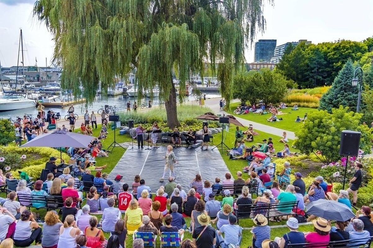
3. Toronto Music Gardens Were Designed After Bach
The Toronto Music Garden is one of the city’s most iconic and must-see places to visit. It sits right at the waterfront, enveloping visitors in the breathtaking views of Lake Ontario and lush greenery.
However, the park offers more than just a serene oasis. The garden was designed by the world-renowned cellist Yo-Yo Ma and landscape designer Julie Moir Messervy, with the inspiration drawn from Bach’s first suite for solo cello (BWV 1007)
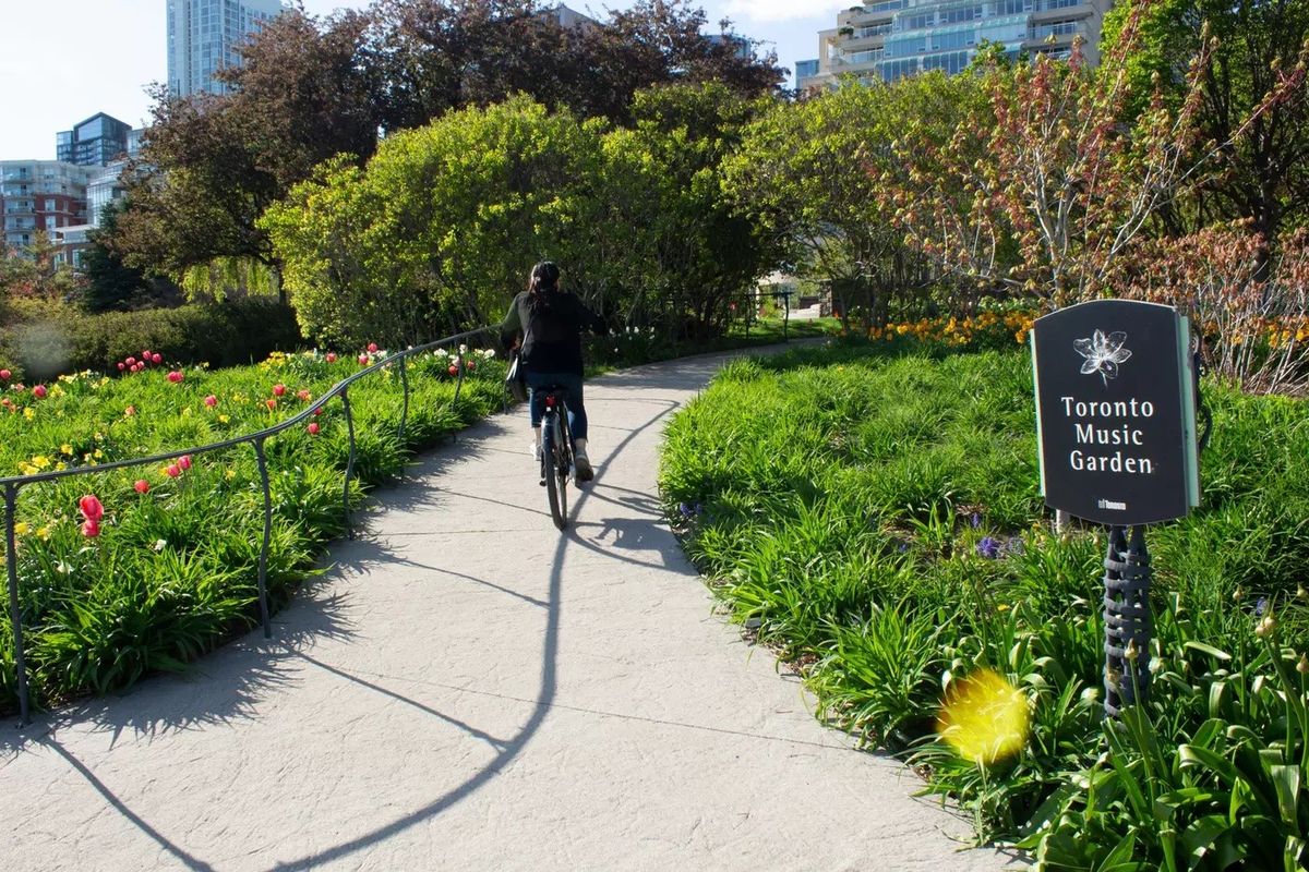
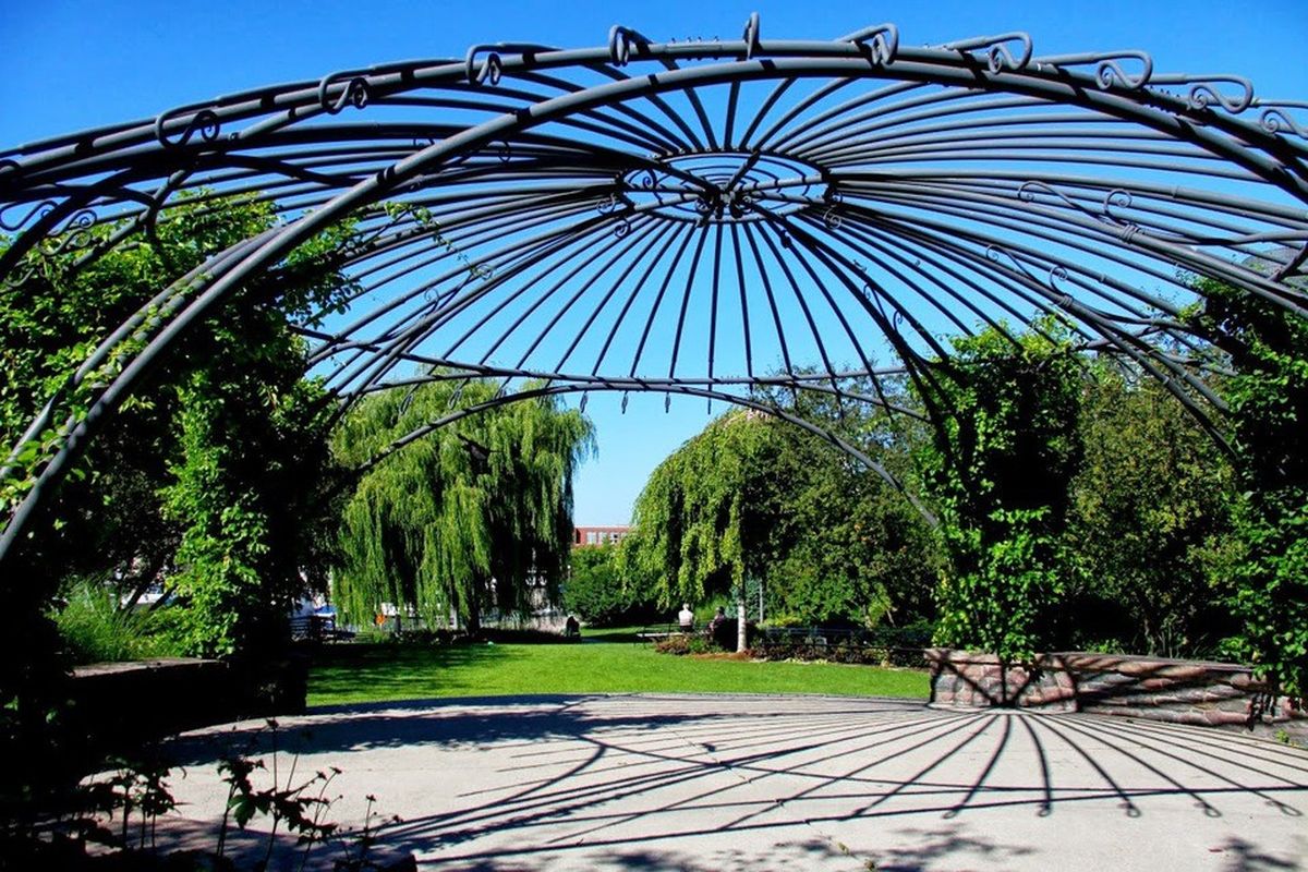
The park is divided into six different sections, each representing one of the suite’s movements. The sections include Prelude, Allemande, Courante, Sarabande, Menuett, and Gigue. The garden’s design is meant to mimic the structure of the suite, with winding paths, flower beds, and rock formations representing the movements’ various rhythms and harmonies.
Every aspect of the park reflects an element of BWV 1007, from the winding paths and wildflowers symbolizing movement to the vast grass steps evoking the final cello solo in the series, Gigue.
The park is also a cultural space that frequently hosts concerts, performances, and events.
Visitors can join guided tours led by volunteers who share information about the garden’s history, design, and the music it represents. The tours are a great way to explore the park and learn more about its significance.
Overall, the Toronto Music Garden is a unique and special place that combines the beauty of nature with the power of music, making it a must-visit attraction for anyone visiting the city.

4. The Whales on the Redpath Sugar Factory
You might have seen the whales on the side of the Redpath Sugar Factory when walking or driving down Queens Quay East. The large outdoor mural with almost life-size humpback whales is hard to miss.
The whales are a great feature to our waterfront, and the history behind the whales adds another layer to the story.
The mural, Heavenly Waters or Wyland Wall No. 70, was painted in 1997 by the American artist Wyland.
The mural was a part of one of the largest environmental awareness campaigns in the world to promote, protect, and preserve the oceans and waterways.
The mural was completely freehand and finished in 5 days.
It was a part of Wyland’s environmental initiative to travel to seven cities and paint seven murals within seven weeks. Since then, his ‘Whaling Walls’ initiative has expanded to 100 murals across the US and Canada.
It’s one of the largest public art projects in history and continues to be seen by one billion people each year.
Toronto features two of his murals, one at the Redpath Sugar Refinery and the second rests in the Royal Ontario Museum.
You can learn more about Wyland’s initiative at the Wyland Foundation.
5. Toronto’s Waterfront Use to Go to Union Station
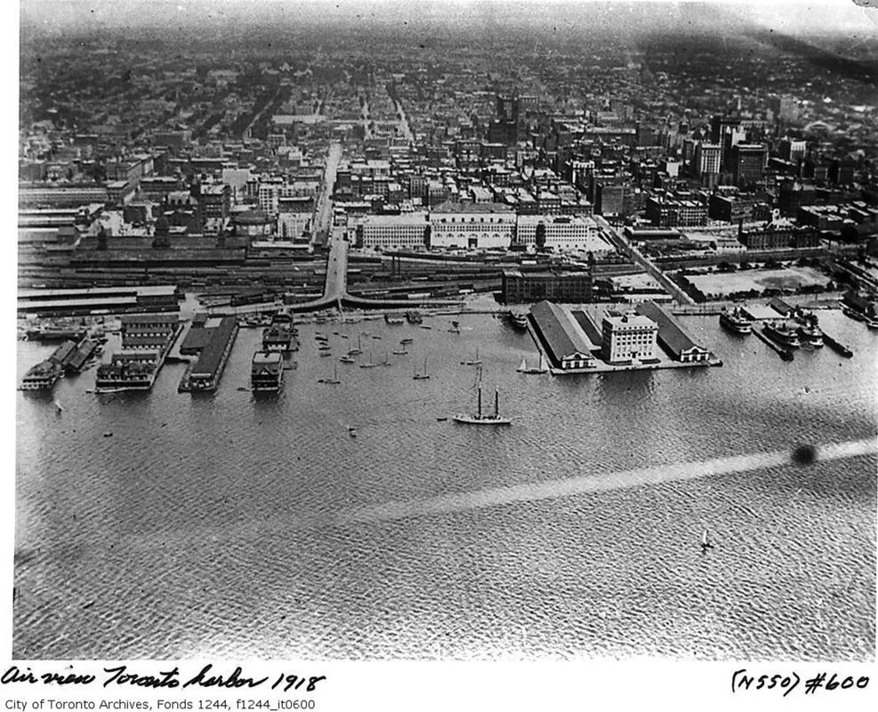
It’s hard to imagine, but the city south of Union station didn’t exist until the 1930s. This part of Toronto used to be all underwater.
In 1911, the Government of Canada established the Toronto Harbour Commission to manage Toronto’s ports and waterfront. And in 1912, the commission created the Waterfront Plan of 1912 to expand the harbour and foster economic growth.
Less than 10 years later, the ports started to fill with dirt from Lake Ontario, and a new waterfront was forming.
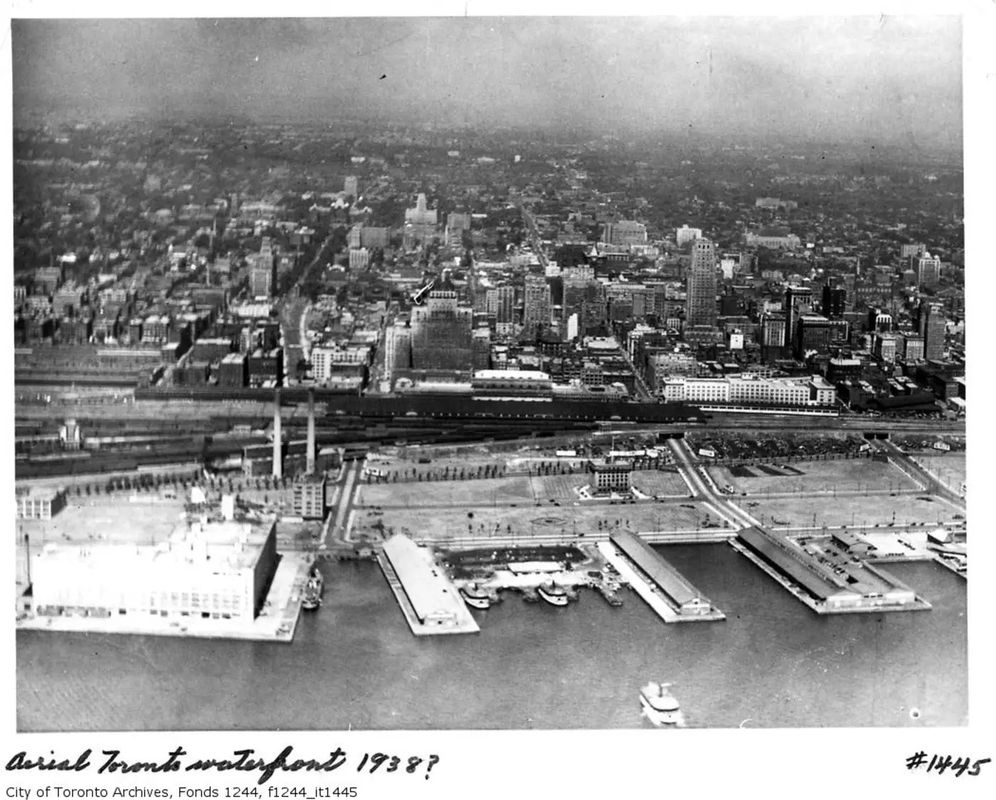
At the time, the city needed more land to turn Toronto into a major shipping port and accommodate the growth. The land expansion plan worked, and by the 50s and 60s, Toronto was moving millions of metric tonnes of cargo from the waterfront annually.
But in the 60s and 70s, the Toronto waterfront experienced another transformation. As the city moved away from heavy industrialization, the waterfront piers and ports became discontinued.
Now the waterfront is home to an urban neighbourhood with condos, parks, and office buildings.
It has become a must-visit destination for people from around the globe, who come to Toronto’s waterfront to relish in the fantastic events and breathtaking lakefront views.
Sources: Boat Sources:
Image Source: Toronto Public Library
Toronto Music Gardens Sources:
Toronto Pride Sources: